



One Network Perception
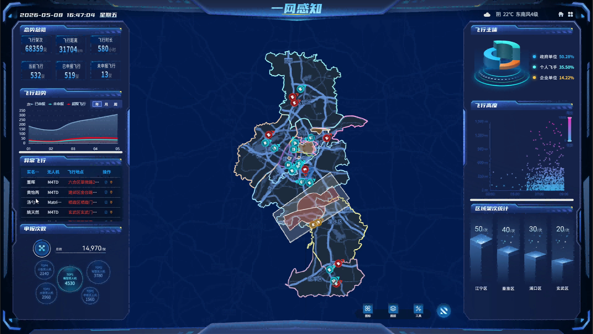
One network perception, as the global low altitude "eye", integrates multiple sources of equipment such as radar, ADS-B, 5G-A sensing integration, optoelectronic monitoring, and radio monitoring to real-time grasp the position, trajectory, status, and airspace environment of all aircraft, achieving all-weather and full coverage low altitude situational awareness that is "visible, distinguishable, and accurately measured".
The platform integrates multi-dimensional perception data and business information to achieve visual monitoring and centralized display of all elements and scenarios related to low altitude flight.
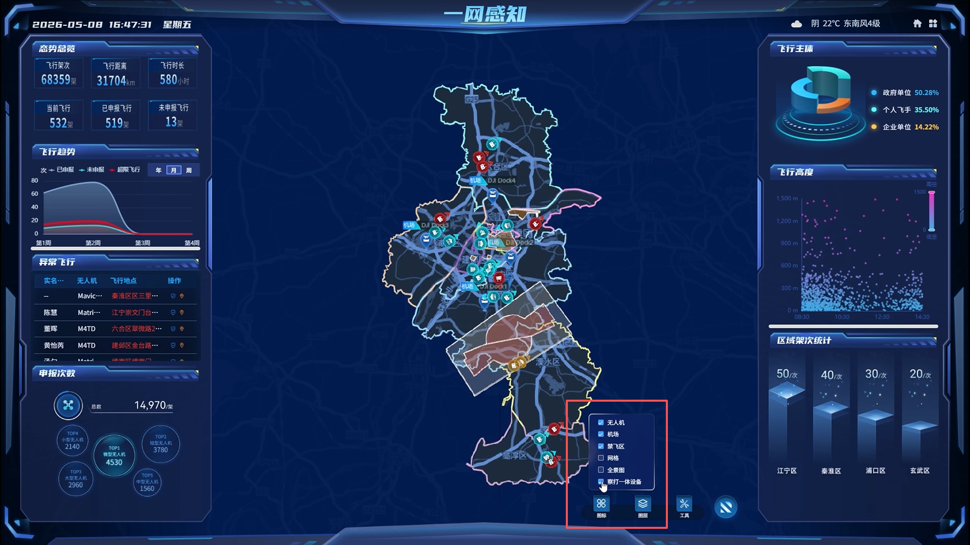
Core GIS map module,Realize panoramic visualization of airspaceOverlay 2D, 3D, and vector data; Support distance measurement, surface measurement, voice interaction and other operations, empowering real-time monitoring and precise perception of low altitude scenes.
Click on different icon function modules to achieve panoramic visualization of airspace, which canScreening drones, airports, no fly zones, and integrated inspection and crackdownWaiting for different devices.
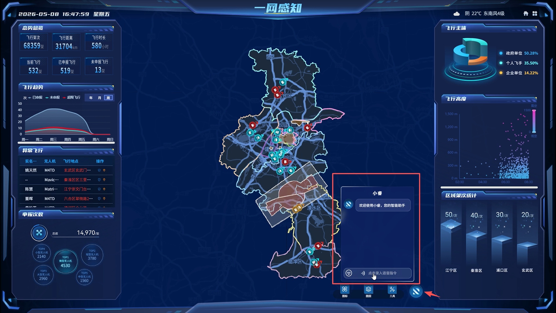
Built in platformAI intelligent agent Xiao RuiIntelligent assistance management personnel are on duty for daily supervision.
To view the overall flight status of unmanned aerial vehicles in the city, simply initiate a voice conversation and issue the command to "generate the current flight heat map"; The system performs real-time speech recognition, automatically retrieves data to generate heat maps, and provides real-time feedback on the results in the dialogue window.
