


Component level real-life 3D modeling, Zhangjiajie close to photogrammetric case detailed explanation
In recent years, real-life 3D has become a hot topic in the surveying and mapping industry. Realistic 3D has been widely used in urban planning, smart tourism, emergency relief, and other fields due to its characteristics of being realistic, intuitive, and high-precision. According to the Notice on Fully Promoting the Construction of Realistic 3D China issued by the Ministry of Natural Resources, by 2050, more than 80% of government decisions, production scheduling, and life planning can be completed through online realistic 3D spaces.
With the comprehensive construction of real-life 3D in China, numerous high-quality projects have sprung up like mushrooms after rain. Last year,The Zhangjiajie real-life 3D project undertaken by the First Surveying and Mapping Institute of Hunan Province has attracted widespread attentionThe project has been successfully selected as one of the top ten typical cases of application scenario construction in Digital Hunan in 2022, and can be regarded as a model of real-life 3D applications in China.
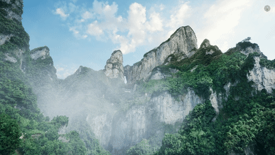
Rendering effect based on real-life 3D Zhangjiajie model
Let's take a look at the new aerial surveying technologies and operational results applied in the real-life 3D Zhangjiajie project together!
The terrain is extremely complex
Complete large-scale real-life 3D construction in 100 days
In 2022, the first Hunan Tourism Development Conference was held in Zhangjiajie. To empower the conference with technology and measure the real, three-dimensional, and handheld Zhangjiajie, the First Surveying and Mapping Institute of Hunan Province, commissioned by the Hunan Provincial Department of Natural Resources and the Zhangjiajie Natural Resources and Planning Bureau, is responsible for implementing the "Real 3D Zhangjiajie" project, constructing digital twin Zhangjiajie urban areas and scenic spots, and fully tapping into the value of real 3D data.
Zhangjiajie has undulating mountains and hills, as well as mountain basins and river valley plains. The terrain and landforms of the entire area are extremely complex. The project team needs to complete the production of 9516 square kilometers of terrain level 3D and 270 square kilometers of city level 3D in Zhangjiajie within a short period of three months, collect 120 kilometers of street views and 202 panoramic data points, and construct 48 core scenic spots and venue ultra fine 3D models.
The project has a tight schedule, heavy tasks, and high requirements. The project team has dispatched 102 technical personnel to Zhangjiajie,adopt29 unmanned aerial vehicles of various types, including DJI M300 RTK and Elf 4 RTKUsing data processing software such as DJI Zhitu, carry out real-life 3D Zhangjiajie project operations.
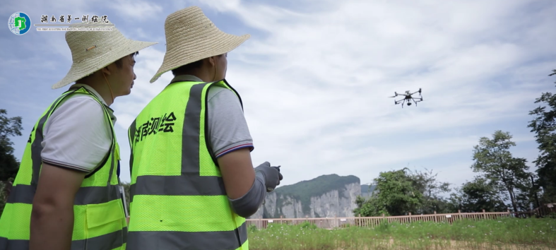
The project team uses the longitude and latitude M300 RTK with P1 for aerial surveying operations
Close to photogrammetric reconstruction of Tianmen Mountain
Resolution better than 0.01rice
In the real-life 3D Zhangjiajie project, completing ultra fine 3D modeling of core scenic areas and venues is an important task. Taking Zhangjiajie Tianmen Mountain Forest Park as an example, the top area of Tianmen Mountain is about 2 square kilometers. The Tianmen Cave Gate is 131.5 meters high, 57 meters wide, and 60 meters deep, with a huge height difference, signal obstruction, variable weather, and extremely complex environment,The traditional oblique photogrammetry method cannot complete the task of fine reconstruction.
Taking into account various factors, the First Surveying and Mapping Institute of Hunan Province, together with the School of Remote Sensing Information Engineering at Wuhan University and the Close Photogrammetry Research Group and Wuhan Duopuyun Technology Co., Ltd., has decided to adopt close photogrammetric technology in Tianmen Mountain and other areas to obtain high-precision geographic information data.
Close proximity photogrammetry is a new photogrammetric technology proposed by the team of Academician Zhang Zuxun from the School of Remote Sensing Information Engineering at Wuhan University, aimed at the precise measurement needs of unmanned aerial vehicles. It takes the "target" as the photographic object and uses the flexible pan tilt of the drone to obtain ultra high resolution images for precise geographic information extraction. Therefore, it can highly restore the fine structure of the earth's surface and objects.From a data perspective, close to photogrammetry can achieve sub centimeter or even millimeter level accuracy.
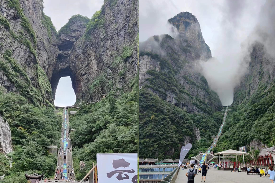
Tianmen Cave has a large height difference, and the environment with frequent rainy and foggy weather poses challenges for homework
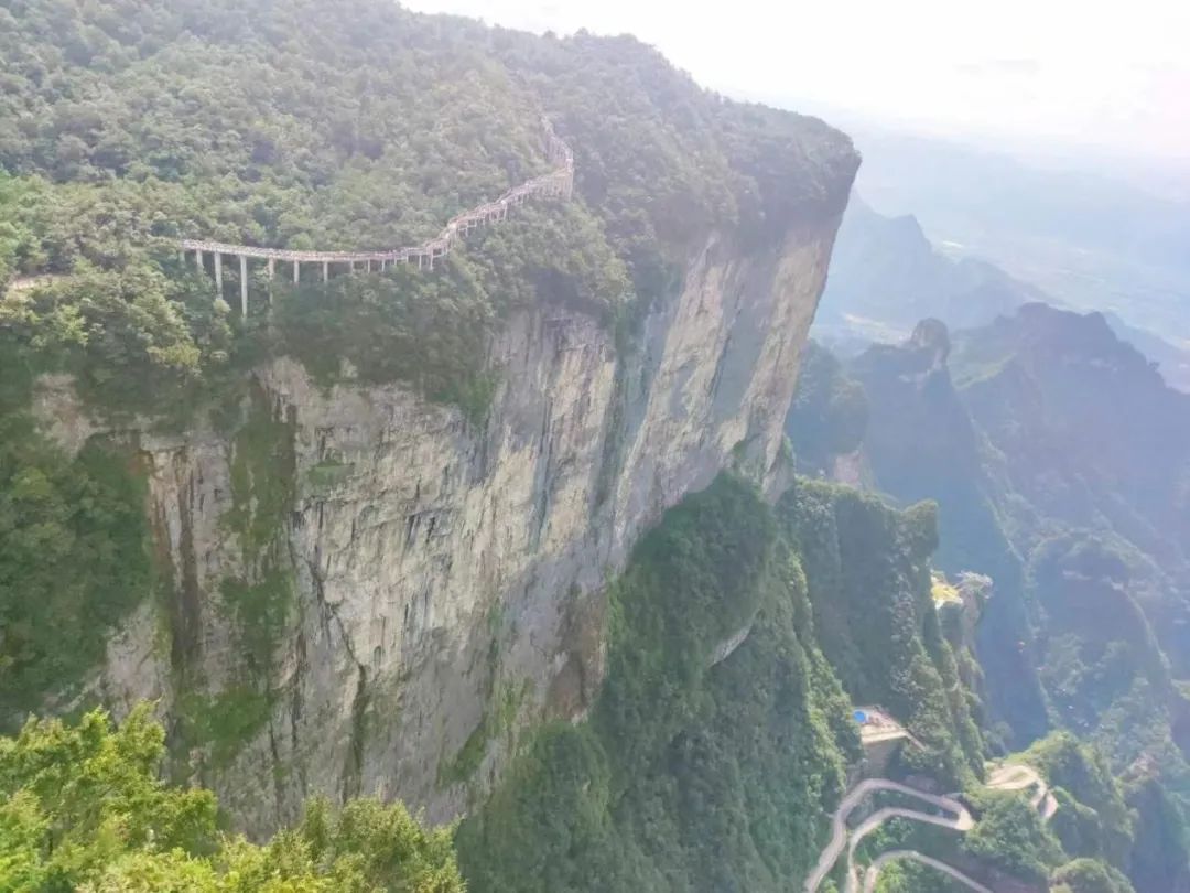
The oversized facade structure of Tianmen Mountain increases the difficulty of the operation
The project adopts a "coarse to fine" image acquisition strategy.Firstly, rough model collection is carried out to obtain the structural information of the target being photographed. By using Elf 4 RTK to collect rough model orthophoto data in the survey area, the data is imported into DJI Smart Map software for 3D reconstruction, generating rough model point cloud data results.
The initial point cloud data was imported into the self-developed photogrammetric software DPGO (computer side) by the research group for fine close proximity route planning. Tianmen Mountain was divided into multiple regular surfaces according to structural information, and parameters such as flight altitude and overlap were set. The shooting angles were set to include "orthography+left-right intersection+up-down intersection" to ensure that all angles of the target object were captured. The flight range was planned and the flight route was automatically generated. The flight route is imported into DPGO (mobile version), and the powerful DJI M300 RTK with full frame mapping camera DJI P1 is used to perform close to the route tasks.
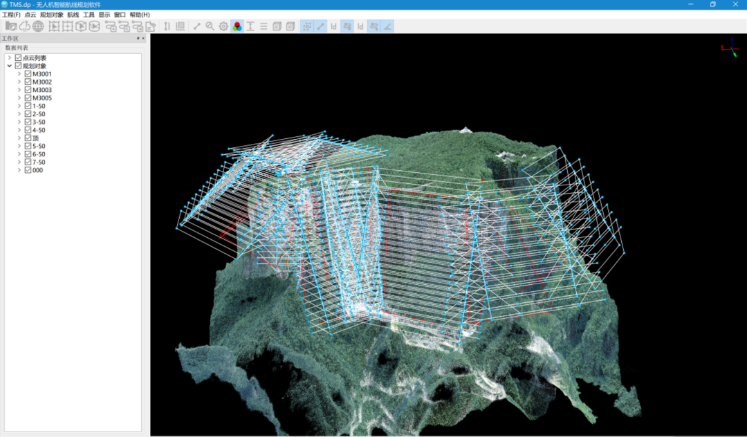
Using DPGO for route planning based on rough modeling
In the end, Zhangjiajie Tianmen Mountain National Forest Park completed a close approximation to the original imageCollected 15630 images, with a data volume of 229GB and a resolution better than 0.01 metersThe highly restored surface and fine structure of the scenic area accurately record the original three-dimensional information of Tianmen Mountain.
The collected data is imported into the DJI Smart Map Cluster Edition for 3D reconstruction. DJI Smart Map has made special optimizations for data collected in close proximity to photogrammetric methods to ensure the generation of high-quality data results. DJI Zhitu can process 6000 images per 1GB of memory and adopts a 10 node cluster configuration[1],High precision model reconstruction of Tianmen Mountain was completed in just 38 hoursTruly restore the terrain and landforms of the scenic area.
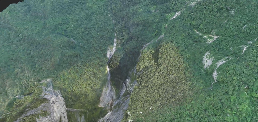
Tianmen Mountain Modeling Results
The real-life 3D model digitally twins every blade of grass and every tree in Tianmen Mountain Scenic Area into a virtual world. The first Hunan Tourism Development Conference will be held in November 2022, and tourists can enjoy a 720 degree view of the scenic area's 3D VR map through their mobile phones or computers. The map reproduces the essence of natural landform and cultural landscape of Tianmen Mountain.
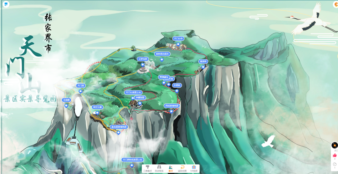
Cloud based Tianmen Mountain 3D VR Map
It is worth mentioning that based on high-precision close proximity photogrammetric 3D models, the project team identified 10 dangerous rock masses with the risk of instability, tipping or falling. To this end, led by Academician Zhang Zuxun and in collaboration with multiple units, a proposal was put forward to the Zhangjiajie Municipal People's Government to strengthen the identification and reinforcement of dangerous rocks in Tianmen Cave. It was suggested to conduct a survey and assessment of the geological conditions and safety risks of Tianmen Cave, which received high attention and action from the municipal government.
48 core scenic spots and venues
Modeling using close photogrammetric techniques
In the real-life 3D Zhangjiajie project, 48 core scenic spots and venues, such as Bailong Tianti, were modeled using close photogrammetric techniques for ultra fine 3D modeling.
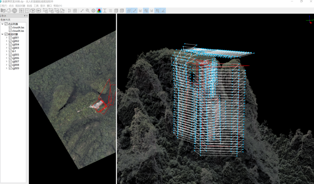
Bailong Sky Ladder is close to the route planning
The vertical height difference of the Bailong Heavenly Ladder is 335 meters, and the geological environment of the mountain is complex. The entire ladder operates at high frequencies throughout the day, and modeling texture details poses a great challenge. The project team conducted on-site calculations of the factors affecting the flight area, divided it into 10 planes, and planned key flight tasks for the top, rock wall side, and ladder front. They used DJI M300 RTK+DJI P1 automatic flight at DJI longitude and latitude,A total of 14076 pieces of data were collected, and the modeling of the DJI Smart Map cluster took 25 hours[1].
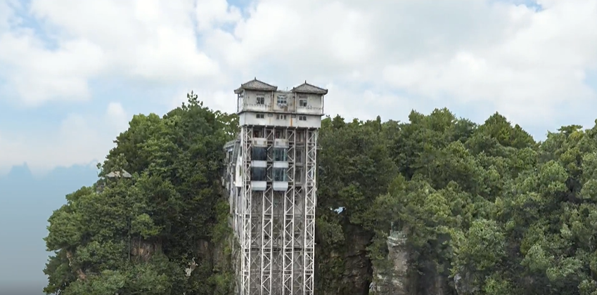
Modeling Results of Bailong Ladder
DJI Industry Applications
Continuously promoting the construction of real-life 3D China
The real-life 3D Zhangjiajie project has achieved fruitful results. The "Cloud based Zhangjiajie VR Map" product integrates 378 aerial panoramic views, 26 3D real scenes, 3 VR real scenes and other data, providing an important data base for Zhangjiajie's smart cultural tourism. It perfectly combines technology and tourism, not only taking tourists to "cloud" tour Zhangjiajie, but also providing "food, accommodation, transportation, tourism, shopping and entertainment" services.
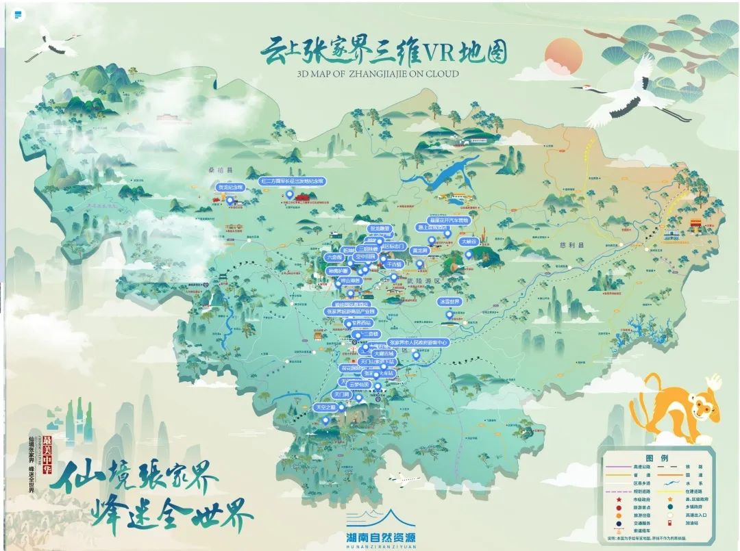
Cloud based 3D VR map of Zhangjiajie
The real-life 3D butterfly transformation will continue. Digital government construction, improvement of living environment, national spatial planning, farmland protection, etcProvide more scientific and accurate surveying and mapping geographic information services.
The DJI aerial survey solution, consisting of DJI industry drones, aerial survey payloads, and modeling software, serves as a new basic surveying and mapping method, covering various scenarios such as real 3D terrain level, city level, and component level in China. It will further promote the development and application of aerial survey technology and provide a strong technical foundation for real 3D China.