


Guarding Changqing Oilfield, unmanned intelligent inspection is done like this!
In March 2022, the National Development and Reform Commission and the National Energy Administration issued the "14th Five Year Plan for Modern Energy System", which clearly stated the need to accelerate the digital and intelligent upgrading of the energy industry, and promote the digital and unmanned management of the construction of "intelligent oil and gas pipelines" and "intelligent oil and gas fields".
China Petroleum Changqing Oilfield Company (hereinafter referred to as "Changqing Oilfield") has a total exploration area of 370000 square kilometers. Since 2013, its oil and gas production has remained at a high level of over 50 million tons for several consecutive years. In 2020, it broke a new record in China's petroleum industry and built a super large oil and gas field with an annual output of 60 million tons of oil and gas equivalent for the first time in China.
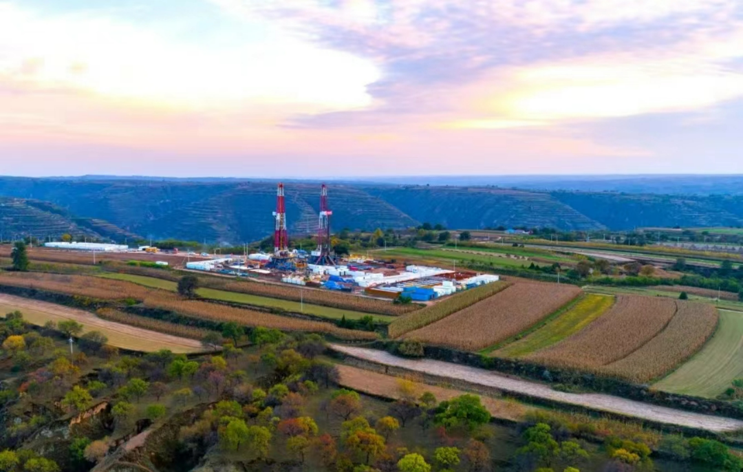
Its work area is located in the Ordos Basin, with a barren desert in the north and the Loess Plateau in the south. There are more than 2300 oil and gas production stations and 100000 kilometers of oil and gas pipelines spread throughout the 200000 square kilometer work area, with many points, long lines, and wide areas, and a fragile ecological environment.
In the traditional manual inspection process, inspection personnel need to travel long distances, some stations are difficult to reach, inspection efficiency is low, hidden dangers cannot be detected in a timely manner, and inspection data is not easy to save, flexible to retrieve and trace. Therefore, it is crucial to introduce advanced technology to achieve digital and unmanned management of oil and gas fields and pipelines.
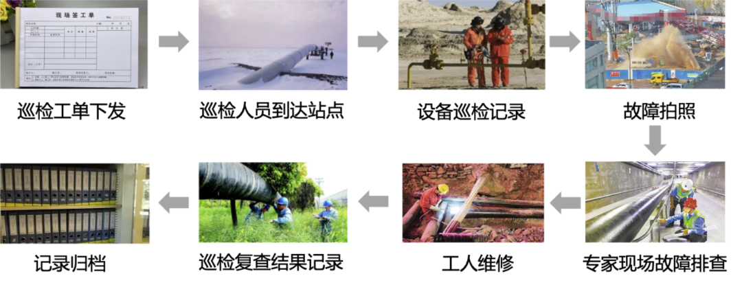
To ensure the safe production of oil and gas fields and pipelines, achieve three-dimensional visualization management, comprehensive nighttime management, and rapid verification of sudden accidents in oil and gas stations,Changqing Oilfield has chosen the intelligent inspection and comprehensive management platform of DJI Airport and Jingjing Huicheng for the construction of unmanned stations.
Rapid deployment of unmanned stations
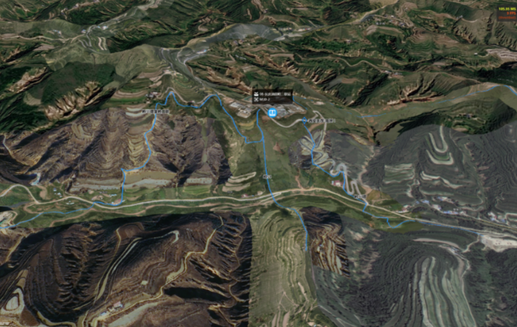
The maximum coverage radius of DJI Airport can reach 7 km. Based on the geographical environment and pipeline distribution of Changqing Oilfield, the installation location of the airport was ultimately chosen at a joint station in Qingcheng as the center of six pipelines. The terrain is high, and the power and network environment are excellent, making it suitable for setting up unmanned equipment.
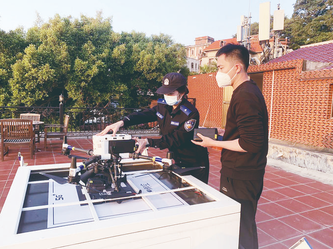
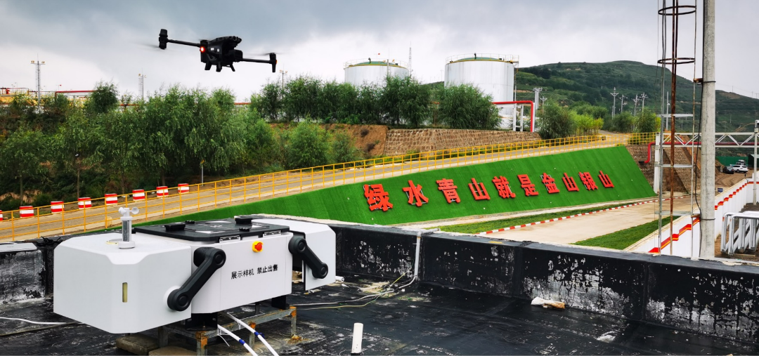
The total weight of DJI Airport is 105 kg, with a modular design that integrates anemometers and cameras. It covers an area of less than 1 square meter and can be easily installed on the roof with simple power on, grid connection, and steel frame support, without the need for excessive debugging work.
Digitalization of oil and gas stations and pipelines
By using DJI M300 RTK and Zenith P1 aerial survey payload, based on the provided pipeline geographic information, continuous flight and ground photography are carried out directly above the pipeline to obtain continuous ground image data, which is then imported into DJI Smart Map,A three-dimensional digital model of the station and buried pipeline surface can be generatedProvide digital support for visual management of stations.
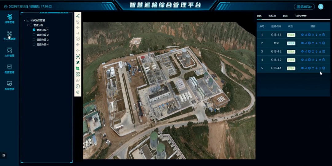
The inspection 3D visualization management system developed based on the intelligent inspection comprehensive management platform can provide visual and illustrated displays for equipment management, personnel management, vehicle management, security, emergency response management, inspection results management, drone management, system management, etc. of the station, greatly improving the daily management efficiency of the station.
Daily inspection of oil and gas stations and pipelines
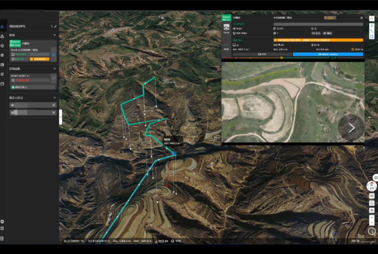
Based on the set route for remote task assignment, DJI Airport can conduct regular patrols of the station, with the joint station as the center, to achieve unmanned operation within a radius of 7km. Inspection personnel can also view flight information in real time through the monitoring window and grasp inspection dynamics.
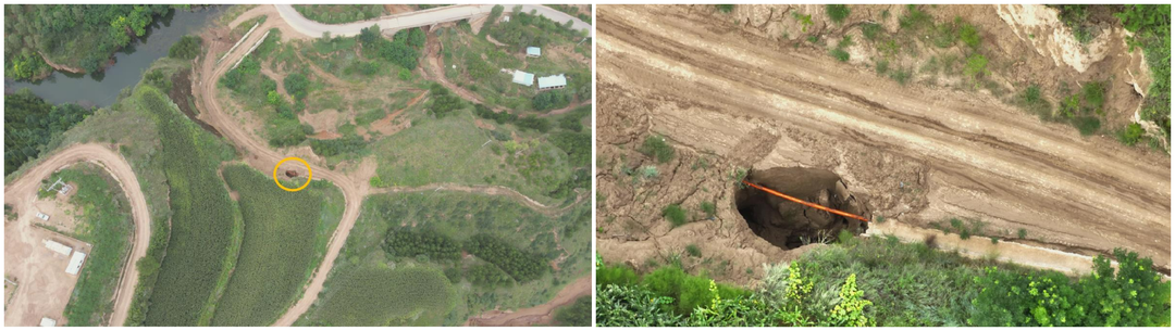
In daily pipeline inspections, drones can capture and automatically identify water damage and collapse of buried pipelines, exposed pipelines, and illegal construction near pipelines. Through high-definition zoom cameras, specific equipment such as key valves, instruments, and bolts can be finely inspected and data collected,And automatically identify and alert security risks through the backend AI intelligent recognition module.
During the 67 days on duty at Dajiang Airport, about 941 pipeline patrol inspections were carried out, especially after special natural disasters such as rainstorm, which increased the frequency of patrol inspections. 35 pipeline collapses were found, 24 pipelines were exposed, 2 illegal vehicle constructions were found around the pipeline, 3 suspected landslides were found around the pipeline, and 1 unknown building was found above the pipeline. All of them were reported to the relevant person in charge of the station at the first time for timely disposal, eliminating the potential safety hazards of pipeline operation.
Comprehensive management of unmanned stations at night
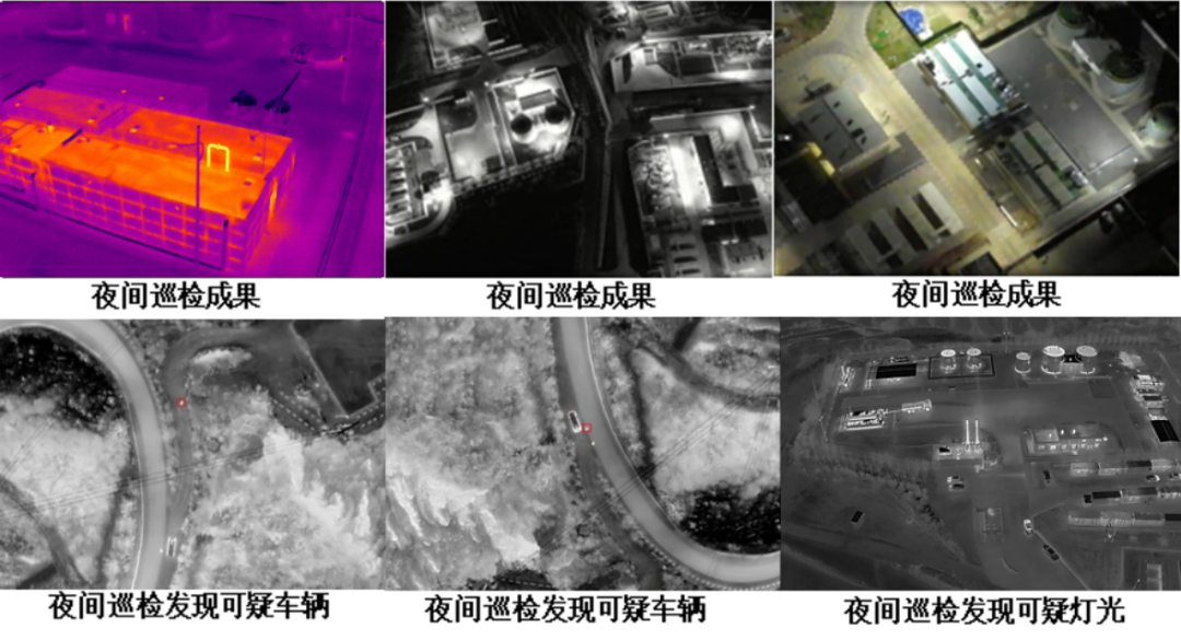
The comprehensive social management and prevention of nighttime oil production areas is an important task in the daily inspection of oil production plants. However, factors such as narrow night vision and inconvenient transportation limit the effectiveness of nighttime comprehensive management. This problem can be effectively solved through unmanned stations.
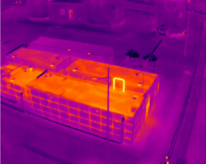
The infrared starlight lens of the drone can clearly capture illegal personnel and vehicles entering the oil extraction area at night, and the inspection time and route can be randomly set according to the task.
Unmanned station AI defect recognition
According to the daily inspection needs of users, unmanned stations have planned a total of 10 inspection paths and carry out 12 day and night scheduled inspection tasks every day. A total of about 73800 inspection materials have been collected, and the AI intelligent recognition module has screened and calibrated the inspection data, obtaining about 230 effective photos of safety hazards (including about 200 photos of exposed pipelines),At present, the accuracy of identifying suspected exposed pipelines can reach 98%.
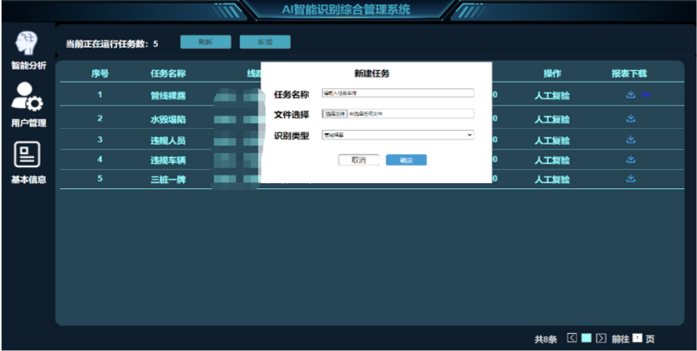
Unmanned station and AI management system for intelligent identification of defects,Increased the detection rate of safety hazards by nearly 10 times, especially after extreme weather such as rainstorm and debris flow, it can realize rapid verification of emergencies.
Since the beginning of this year, the unmanned scale of Changqing Oilfield stations has continued to expand, completing the renovation of 107 old oilfield stations, 6 gas gathering stations, and 99 large-scale stations with few people for centralized monitoring. By the end of 2023, the coverage rate of unmanned stations in Changqing Oilfield will reach 100%, accelerating the digital transformation and intelligent development of the energy industry.
In the future, DJI's industry applications will continue to work with a wide range of ecological partners to carry out technological innovation, empowering intelligent inspections in oil fields, pipelines, refining and other scenarios through advanced technology and digitization, providing safe, reliable, convenient and efficient "partnering" tools and comprehensive solutions for unmanned and intelligent operation and maintenance in the energy industry.