


Drones with "Fire Eyes and Golden Eyes" assist in forest firefighting and hardcore fire prevention!
Since the beginning of winter, a cold wave has struck, the weather is dry, and forest fire prevention work across the country has entered a critical period. In order to prevent and reduce the occurrence of forest fires, and fully utilize modern technological means, various regions have adopted drones for forest fire prevention inspections, improving the efficiency and warning capabilities of forest fire prevention inspections, and weaving a three-dimensional forest fire protection network.
Pain points of traditional forest fire prevention
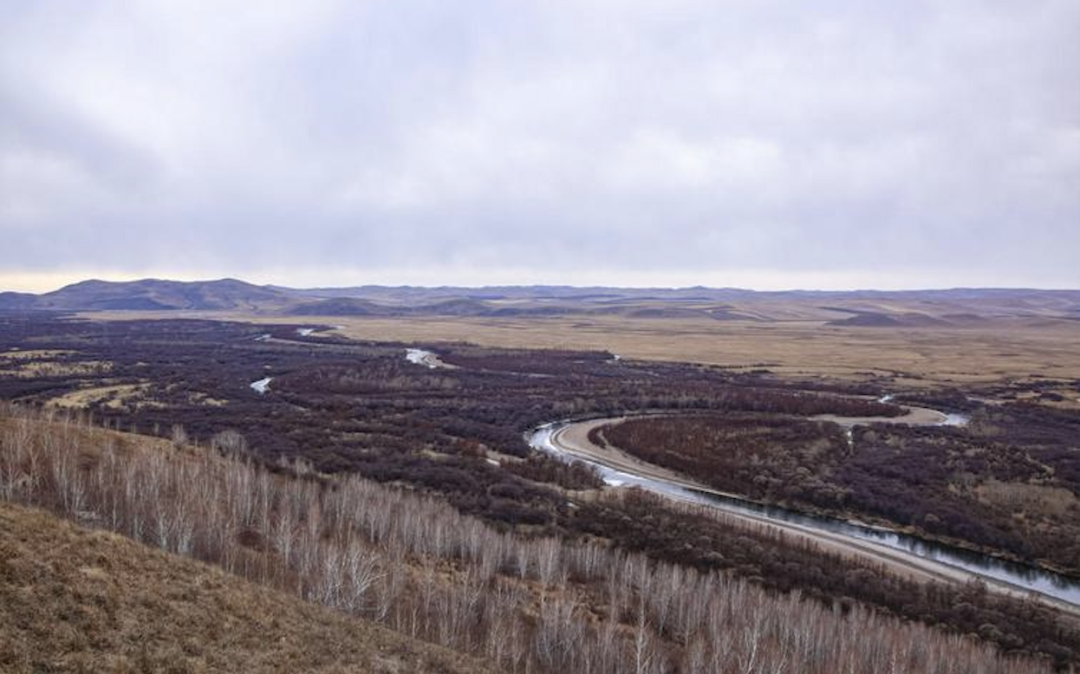
Throughout the years, forest fire prevention work has mainly adopted a combination of fixed monitoring by watchtowers and hiking tours by forest rangers. However, the observation effect of watchtowers is limited by the terrain, with small coverage, blind spots, and gaps. Watchtower itself is a method of observation that relies on the experience of watchtowers, with low accuracy and large errors. The forest area is vast and the roads are rugged and difficult to open to traffic, which makes manual inspections time-consuming, laborious, and labor-intensive.Therefore, how to improve the efficiency and accuracy of fire prevention inspections and timely detect abnormal high temperatures has become the top priority of current forest fire prevention work.
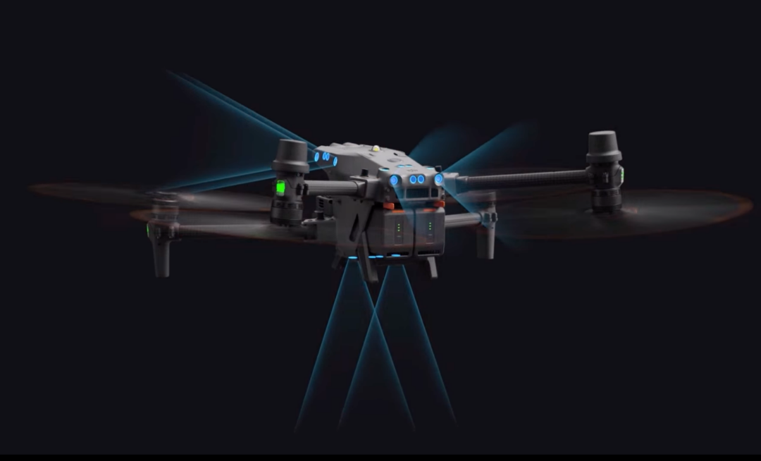
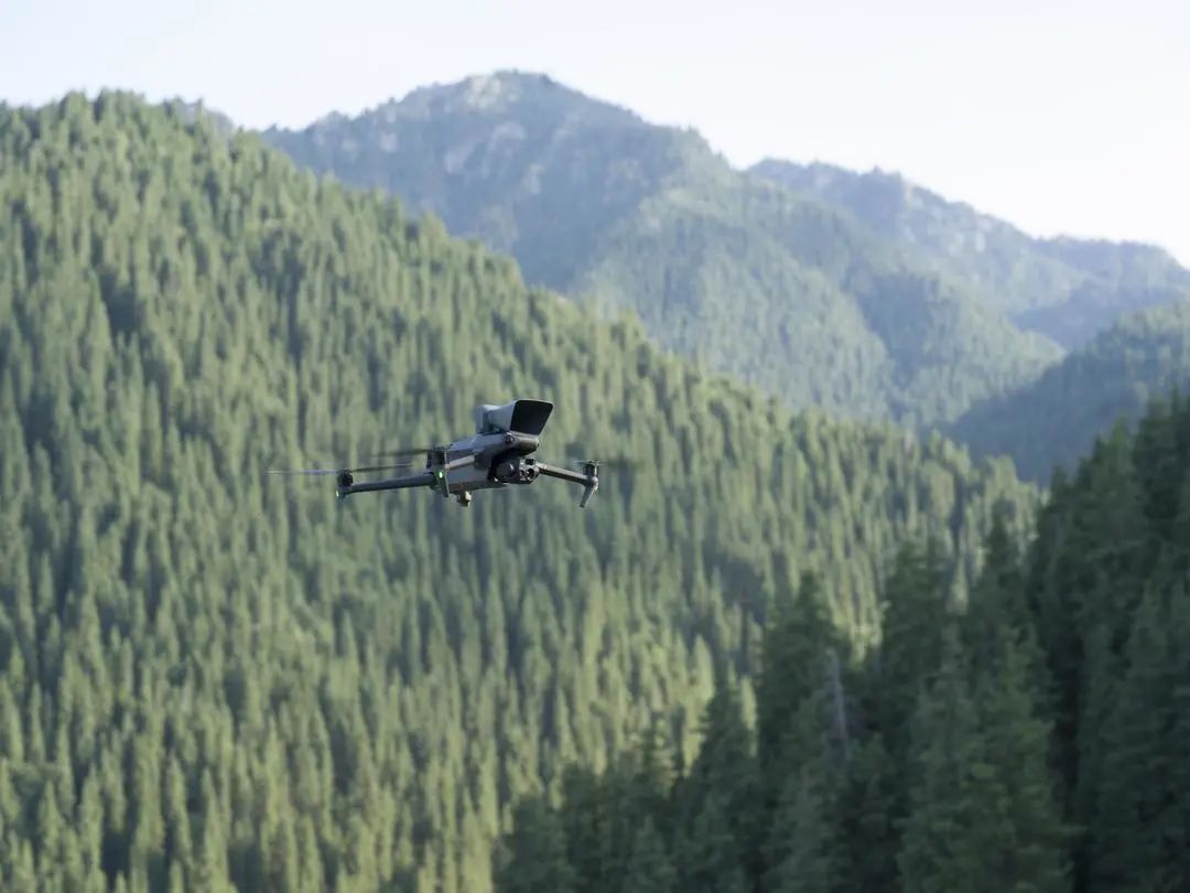 Mavic 3T drone equipped with a loudspeaker
Advantages of drone patrol
Using drones for fire prevention inspections, with the advantageous advantages of high-altitude perspective and real-time image transmission, inspectors can comprehensively see various dynamic information in the forest area, timely discover fire hazards such as fire and smoke points in the forest area, and effectively improve the efficiency of forest inspections. At the same time, in response to the objective pain points of complex road environments in forest areas and difficulty in carrying inspection equipment, the Mavic 3 industry series can achieve "in the pocket", greatly improving portability and single person inspection efficiency. Combined with loudspeakers, lighting fixtures, and other loads, the patrol call is combined to meet the needs of various forest inspections and assist in forest fire prevention inspections.
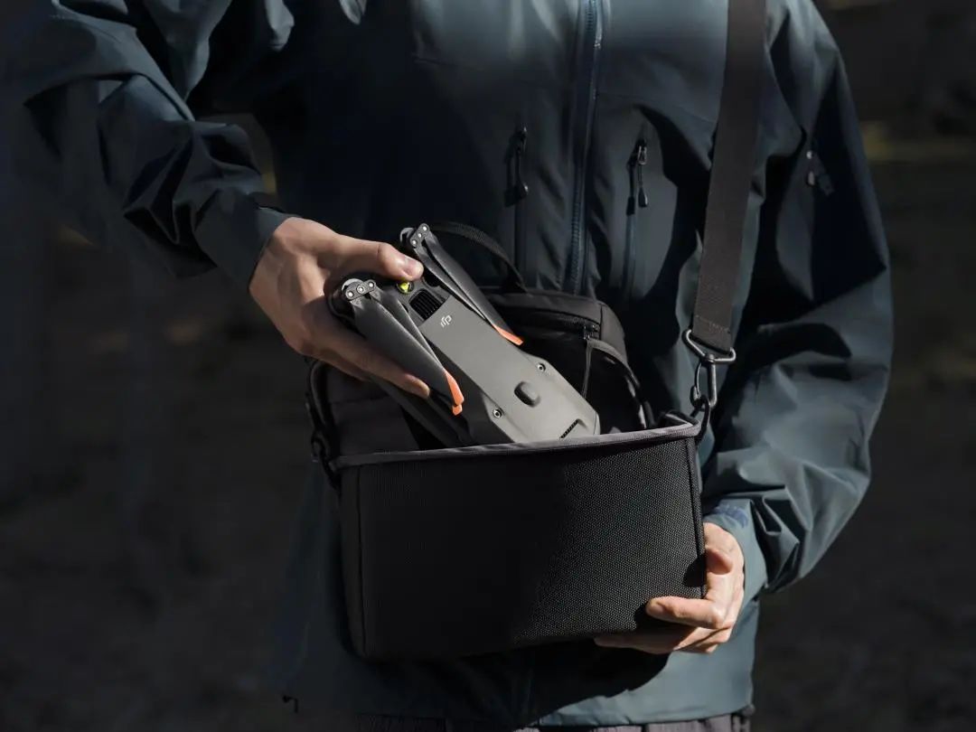
Extremely portable, a powerful tool for patrol in the bag
When a fire occurs, drones can penetrate smoke through infrared thermal imaging lenses to intuitively obtain key information on the fire scene, geographical location, and fire spread trend, providing information support for disaster assessment in the first time and providing "hardcore" technological assistance for protecting forest resources and the safety of people's lives and property.
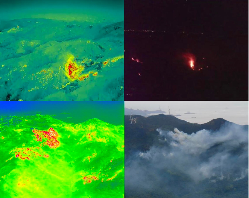
Comparison between drone thermal imaging image and visible light image
Unmanned aerial vehicle forest fire investigation solution
At forest fire prevention and extinguishing sites, DJI industry drones can perform fire and fire reconnaissance tasks at a distance of 300-1200 meters in the air. The thermal imaging camera carried by the drone can directly and accurately locate the location of the fire source, and at the same time, laser rangefinders are used for point positioning to depict the fire line, connecting points and lines,Draw a panoramic image to supplement the 3D image of the fire area and provide accurate information input for disaster assessment.
The on-site fire information is uploaded to the cloud with one click through the Sikong 2 task management system, synchronized in real-time across multiple terminals, ensuring effective coordination between the air and ground and real-time distribution of fire scene information, providing comprehensive and real-time situational awareness capabilities for firefighting and rescue work. During the residual fire cleaning stage, the thermal imaging area temperature measurement mode is used to measure the temperature of the fire area and set temperature alarms. The drone uses the infrared temperature measurement function during the fire patrol to quickly locate the temperature abnormal area after setting the high temperature alarm, preventing the fire from resurrecting.
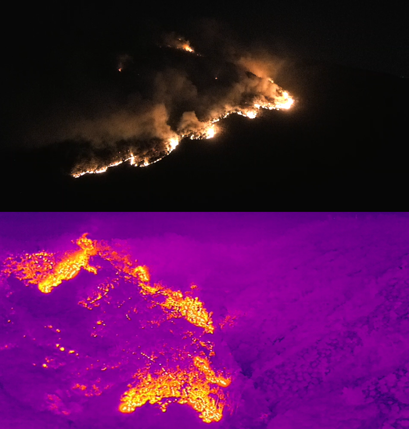
Real time monitoring of live fire dynamics under thermal imaging lens
Unmanned forest fire prevention solution
Efficient and all-weather unmanned patrols have always been a persistent problem in forest fire prevention work. According to traditional methods, whether it is manual inspection or the combination of "human defense" and "technical defense" through the use of new equipment, there are contingencies and limitations in the frequency and coverage of patrols.
At the application level of drones, most drone users in various industries still use manual or semi-automatic operation modes. The operation process requires personnel intervention, and the manpower requirements are high. At the same time, the operation results depend on the skill level of the pilots, and the operation threshold is high. Based on the analysis of the pain points in the aforementioned business,The unmanned forest fire prevention solution used in conjunction with DJI Airport and Sikong 2 has emerged,Create a new mode of automated homework.
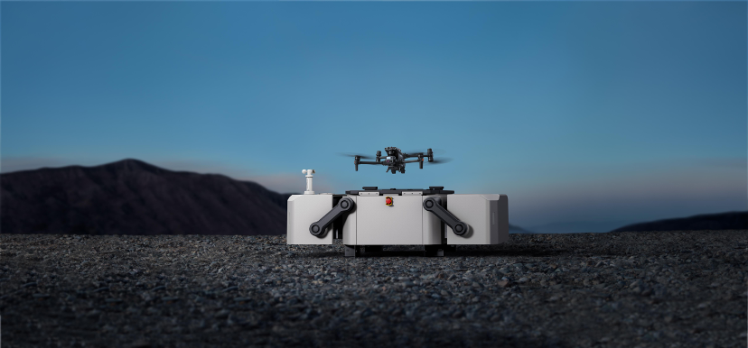 DJI Airport
The meteorological environment in forest areas is complex, and DJI Airport has strong environmental adaptability. It can operate 24/7 without human supervision, regardless of extreme cold or heat. By remotely developing flight plans and automatically executing tasks through DJI Sikong 2, complex labor is liberated.
In addition, after DJI Airport is connected to the local emergency response system, when a fire occurs, the unmanned aerial vehicles that receive instructions will quickly take off and rush to the scene, transmitting disaster images and other information in the first time, greatly pre determining the fire situation, ensuring "fast dispatch, fast reconnaissance, fast warning, fast response, and fast image transmission", and improving the efficiency of forest fire prevention and extinguishing,Ensure early detection and disposal of fires, and achieve the goal of 'fighting early, fighting small, and fighting'.
Since the establishment of DJI Industry Application in 2017, industry drones have assisted in firefighting and rescue work in multiple major forest fires, including the 2019 Foshan fire, the 2020 Liangshan Prefecture forest fire in Sichuan, and the 2022 Chongqing fire.In response to the characteristics of forest fires, such as rapid spread, complex fire situations, and difficulty for vehicles and manpower to reach the scene for firefighting, drones use infrared thermal imaging systems to clearly identify the fire area, providing key decision-making information for analysis of fire spread and fire defense work, and assisting local firefighting commanders in fire situation assessment and disaster relief deployment.DJI's unmanned aerial vehicles (UAVs) industry is constantly summarizing their practical experience, upgrading and iterating their products to provide more convenient and practical solutions for the forest firefighting field.
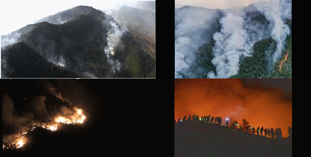
With the landing of DJI Airport on the front line of forest fire prevention, the importance of drones in responding to major forest fire incidents, tactical warfare research, fire prevention and rescue, and other fields is increasingly increasing. In the national emergency fire protection system, the relevant spirit of the 20th National Congress of the Communist Party of China on "great safety, great emergency response" is deeply implemented, and safety and development are well coordinated. DJI will fully leverage its advantages in the drone industry and further explore equipment system construction, major event linkage response, and other aspects in the future. The most advanced technology and modern technological development achievements will be applied to the forest fire protection industry to improve forest fire prevention and extinguishing efficiency with technology.