


11 times efficiency improvement | Drones assist in intelligent operation and maintenance of Anhui Energy Group's 2GW power plant
In recent years, China's clean energy has achieved leapfrog development, and the effects of energy structure adjustment and carbon reduction have gradually emerged. As an important carrier of carbon neutrality in China, photovoltaic power generation needs to continuously improve the production and operation safety of photovoltaic power plants in the process of promoting global energy transformation. Comprehensively promoting the deep integration of photovoltaic industry and new generation technologies such as drones will help accelerate the realization of intelligent applications and operations, and improve the quality of China's photovoltaic industry development.
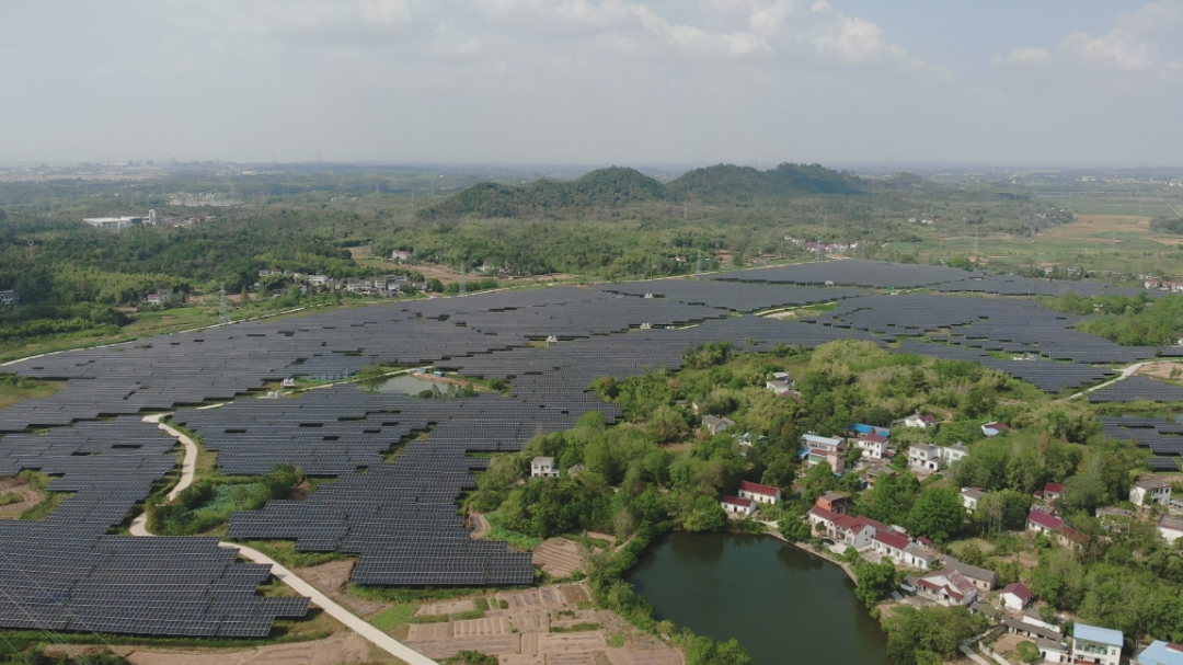
Wanneng Group Tonghua Power Station Project Base
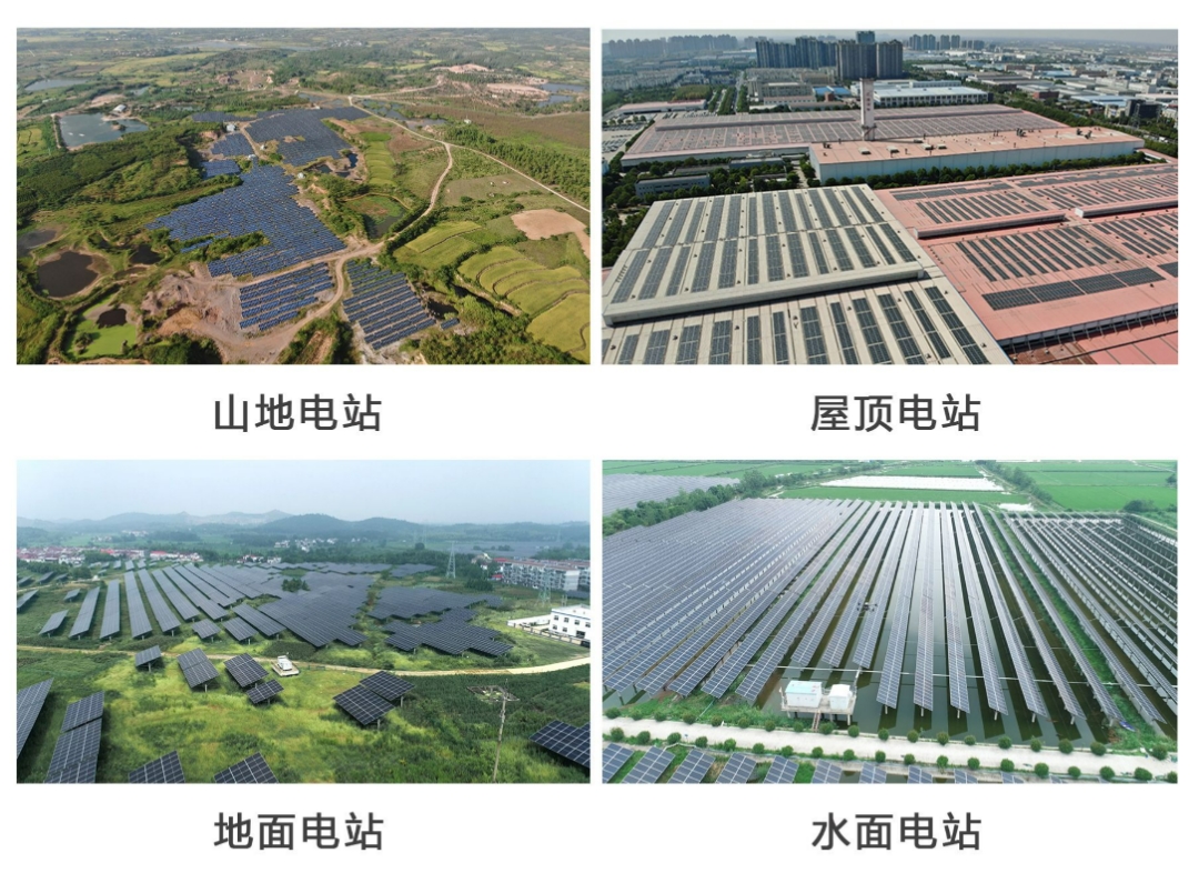
Anhui Energy Group Co., Ltd. (hereinafter referred to as "Anhui Energy Group"), as the main force of energy structure adjustment and "dual carbon" action in Anhui Province,The installed capacity of the new energy power station reaches 2GWThe types of power stations are complex and diverse, covering various terrain environments such as mountains, water surfaces, ground, roofs, etc., which poses great challenges to the operation and maintenance management of power stations.
To promote the construction of digital power stations and empower high-quality development of power stations, DJI has partnered with Shangtejie Electric Power Technology, a new energy industry partner, to provide Anhui Energy Group with a complete set of unmanned aerial vehicle intelligent inspection solutions for new energy power stations.
Multidimensional intelligent power station visual inspection
The Anhui Energy Group project has a large scale and complex and diverse types of power stations. Traditional manual inspections have problems such as imprecise inspections, difficulty in locating faults, lack of standardized diagnosis, multiple safety hazards, and difficulty in ensuring efficiency.
This project adoptsDJI M30T and DJI M300 RTK unmanned aerial vehiclesBy equipped with high-definition visible light+infrared thermal imaging cameras and other intelligent sensors, it ensures a higher fault detection rate and achieves efficient diagnosis of faults such as "diode/obstruction". Combined with RTK positioning, it can accurately navigate to the location of faulty components and flexibly respond to various difficulties in different types of power stations and the entire inspection process.
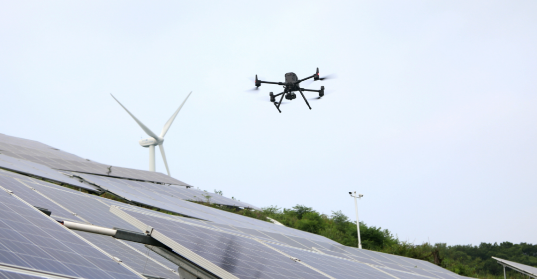
DJI Jingwei M300 RTK equipped with Zenith H20T inspection operation
Digital modeling is the key to intelligent operation and maintenance of photovoltaic power plants. Obtaining accurate 3D models of power plants is of great significance for inspection work.
The DJI M300 RTK drone can be equipped with a Zenith P1 pan tilt camera to capture and collect detailed geographic information and equipment conditions of the power station, and efficiently reconstruct them through DJI Smart Map software.
The modeling process is highly intelligent and easy to use. Whether it is undulating mountainous areas or continuous ponds and farmland, clear and accurate digital models can be obtained, achieving full coverage of power station inspections and effectively solving the problem of visual blind spots caused by the large variety of component types and orientation differences in the Anhui Energy Group project.
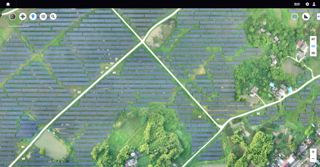
Modeling diagram of Wanneng Tonghua Power Station
On the basis of the digital model of the power station, Wanneng Group further uses the intelligent station digital control platform,Convenient and accurate planning of inspection routes. The DJI M300 RTK and M30T unmanned aerial vehicles can fly autonomously along the route to perform inspection tasks, avoiding the disadvantage of inability to guarantee the quality of results in manual flight and reducing the ability of pilotsThe threshold requirement is to help the flight team of Wanneng Group conduct daily inspections more conveniently and efficiently.
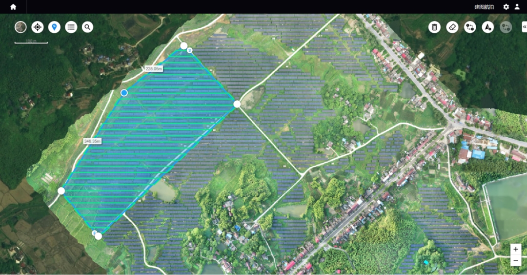
Route Planning Map of Wanneng Tonghua Power Station
In addition, the DJI Jingwei M300 RTK and Jingwei M30 series unmanned aerial vehicles possessSix directional environmental perception ability,Capable of handling flight tasks under different working conditions, whether in undulating mountainous areas or other complex environments, ensuring flight safety and making operation and maintenance work efficient and worry free.
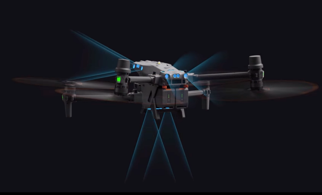
The Jingwei M30 series is equipped with 6-way visual and near-infrared sensors
Component level refined inspection
DJI drones can be equipped with various types of sensors such as zoom cameras, wide-angle cameras, thermal imaging cameras, and laser rangefinders. Through high-definition visible light photos and thermal imaging images, they can easily detect thermal spot defects caused by diodes, string drops, dust, bird droppings, vegetation obstruction, fragmentation, etc., taking into account both the overall situation and details of the power plant, breaking through the limitations of human visual inspection, and facilitating the quick detection of faults by operation and maintenance personnel.
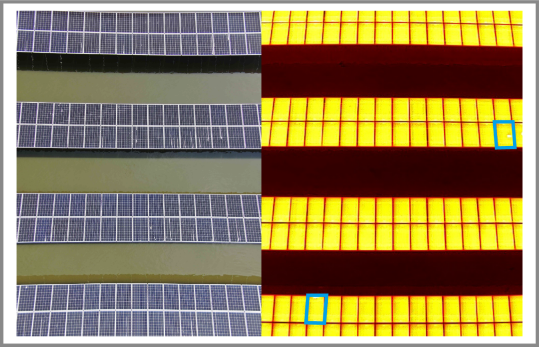
Fault Defect Diagram
Through the algorithm positioning function, the fault target can be marked with one click on the camera screen, achieving centimeter level automatic positioning. Power station operation and maintenance personnel can quickly review and eliminate defects based on the positioning navigation.
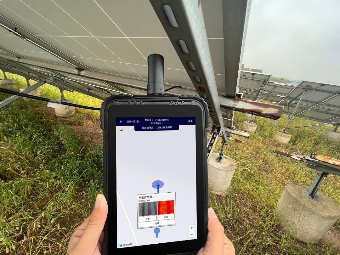
Fault location and navigation
Through development technologies such as SDK and cloud API, inspection data can be transmitted in real-time to a third-party intelligent station digital control platform, providing comprehensive and accurate understanding of the real-time situation of the power station. The unmanned aerial vehicle (UAV) integrated diagnosis platform for wind, solar, and line inspection can achieve fully automatic identification of image faults based on high-definition original images provided by UAVs and the fusion of infrared and visible light data, using AI image processing algorithms,The accuracy is as high as 95%, breaking the problem of no clear standard for human inspection to identify faults at Anhui Energy Power Station.
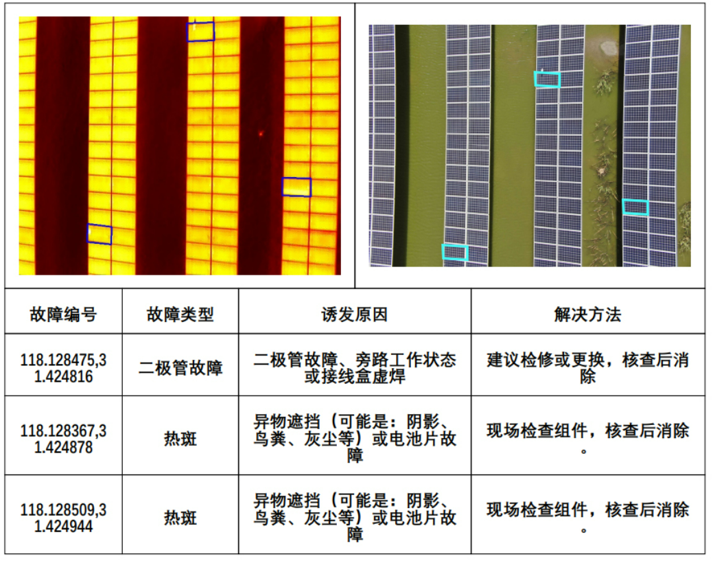
Fault identification analysis diagram
After the inspection is completed, there is no need for the power station to manually organize the information. The system will automatically generate a fault report, covering complete information such as fault pictures, specific types of faults, and fault locations. The work line will be distributed to the inspection personnel, greatly improving the overall process efficiency from discovering faults to solving them and reducing operation and maintenance costs.

One click generation of inspection report
Digitization,Intelligent separation of centralized control inspection
In response to the large scale, nationwide coverage, multi-level architecture, and dispersed power stations of Anhui Energy Group's projects, DJI drones and Shangtejie Smart Station Digital Control Platform are linked to provide real-time monitoring, historical data analysis, multi station system coordination, comprehensive planning and management, and other functional modules, achieving unified management of the group, region, and station, and comprehensively improving the digital and refined management level of Anhui Energy Group's power stations.
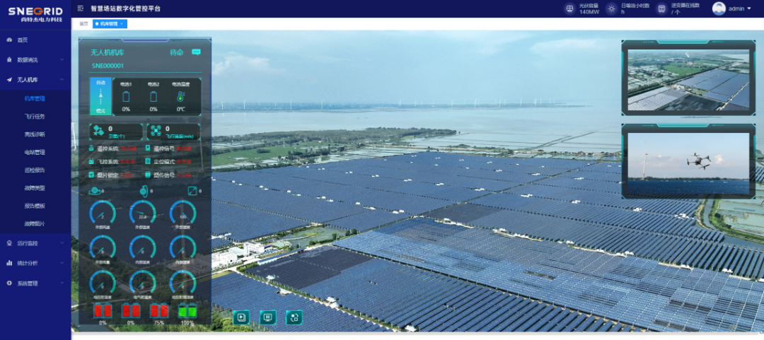
Wanneng Tonghua Power Station Comprehensive Management Platform
Taking the 80 MW project of Tonghua Photovoltaic Power Station as an example, originally six operation and maintenance personnel needed about 15 days to complete a full site inspection, but now only 1-2 people are needed to operate drones for a daily inspection of 4 hours, which can be completed in 3-4 days. The inspection efficiency has been greatly improved,Recovering nearly 800000 yuan in economic losses annually.
Empowered by technology, "unmanned and less manned" is the inevitable choice for photovoltaic power plants to reduce costs and increase efficiency. In the future, DJI will also collaborate with a wide range of ecological partners to expand the application scope of the industry with higher quality products and professional solutions, bringing digital and intelligent changes to power station inspection and operation, and helping to achieve the "dual carbon" goal as soon as possible!