


One click panoramic view and infrared monitoring to ensure chemical fire rescue
At around 13:17 on August 26, 2022, a fire broke out in a chemical film factory. After receiving the alarm, local and surrounding firefighting forces quickly rushed to the scene for disposal. The DJI Emergency Alliance also coordinated with its members nearby in the first time, cooperating with firefighting and rescue units to carry out disaster investigation and assistance work.
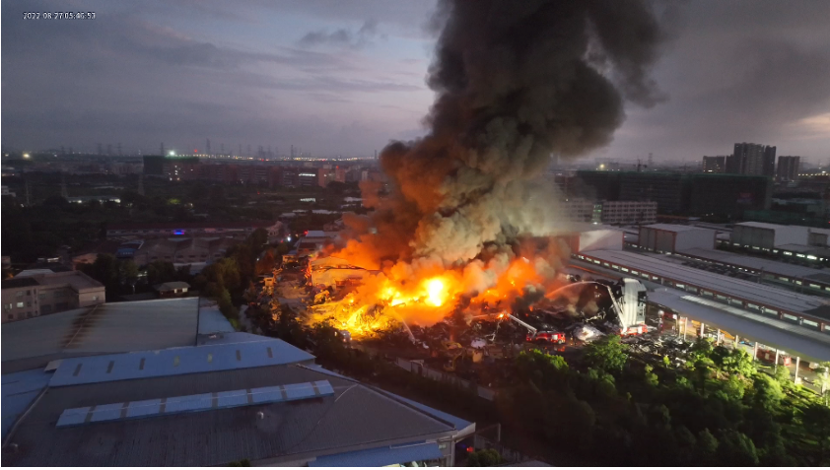
Disaster scene
UAV high-altitude situational awareness
Assist in the analysis and judgment of complex fire situations
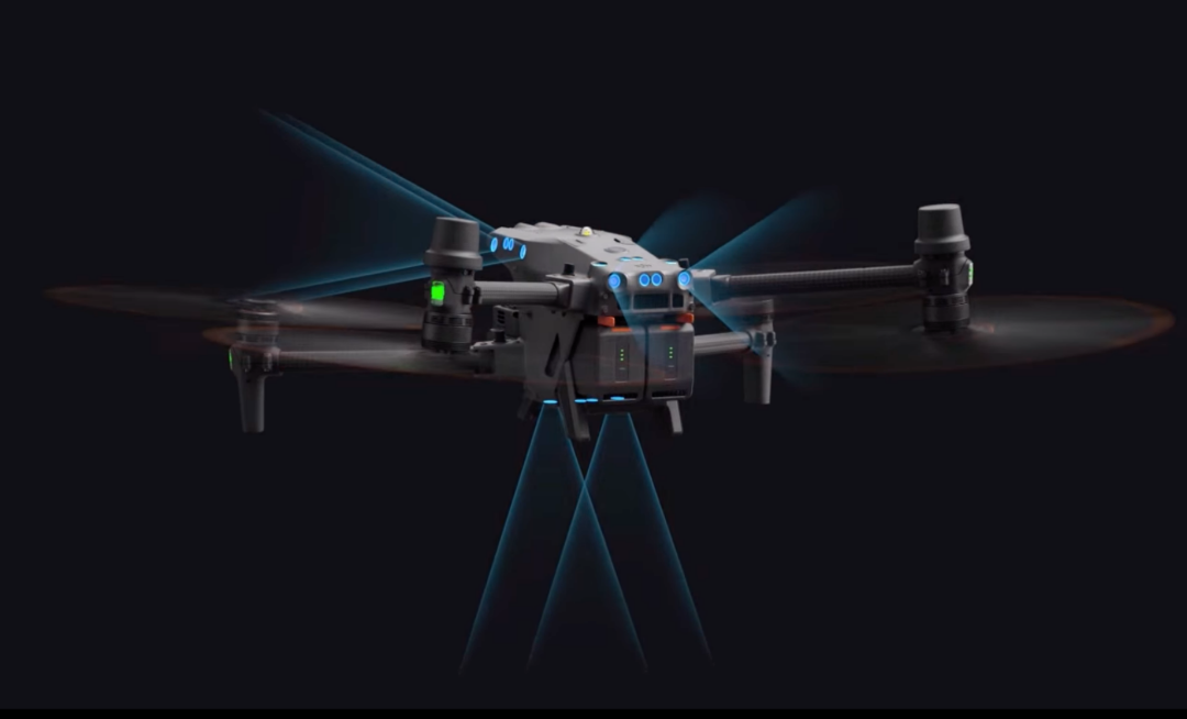
After preliminary understanding, the building on fire is a steel structure factory building, and the main combustion material is polypropylene, which has the chemical characteristics of being flammable and not easily extinguished. After communicating the security requirements, the alliance members quickly deployed the DJI Mavic 3T drone, providing a high-altitude reconnaissance perspective and conducting panoramic photography.Summarize and present the collected information through the DJI Sikong 2 platformAssist the rescue command center in assessing the disaster situation and deploying resources.
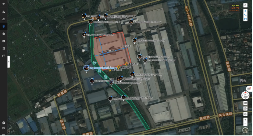
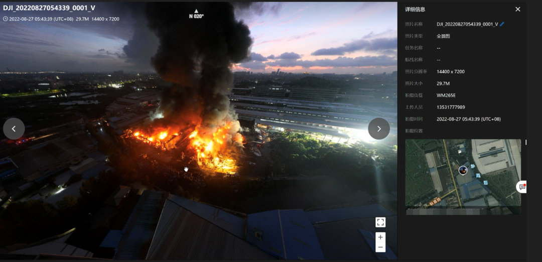
Sikong 2 consolidates information and collaborates efficiently
At the scene of the fire, the high temperature caused by continuous combustion poses a huge risk for the collapse of large-span steel structure factories at any time, and frontline rescue personnel approaching for investigation will face enormous risks. To accurately determine the ignition point,Using Mavic 3T thermal imaging cameraBy using functions such as point temperature measurement, area temperature measurement, and temperature alarm to set temperature measurement intervals, smoke interference can be efficiently eliminated for fire point positioning, and the direction of the fire can be quickly identified. This enables the command center to further grasp fire information while ensuring the safety of frontline rescue personnel.
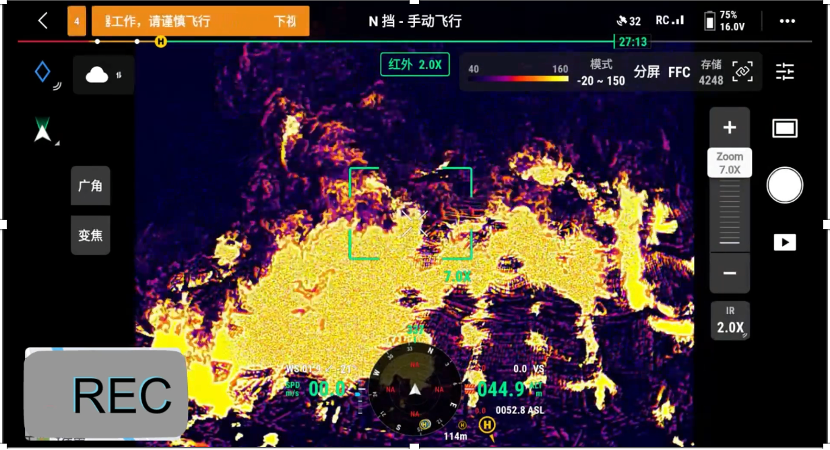
Infrared thermal imaging image
Real time monitoring of infrared thermal imaging
Insight into combustion trends
The conventional firefighting method for chemical fires such as polypropylene is to control the fire and wait for it to burn completely. However, the area near the fire site belongs to the printing and packaging industry cluster, with multiple printing and packaging enterprises and paper trading companies hoarding large amounts of raw paper. Once the fire spreads, the consequences are unimaginable. Therefore, disaster monitoring is the top priority of rescue work.
Drones monitor fire scenes in real-time through visible light and thermal imaging cameras, and prolonged burning poses higher demands on the endurance of reconnaissance drones than ever before. The Mavic 3T has a maximum endurance of 45 minutes, which greatly meets the needs of long endurance reconnaissance.During the smoking point and residual fire care stageContinuously observe whether there is a temperature rise and reignition phenomenon through an infrared camera, ensuring continuous aerial view of the fire area and real-time updates of dynamic information.
Looking back at this rescue operation, Mavic 3T efficiently synchronized data with the Sikong 2 platform, providing information support for on-site command and decision-making in the first time, effectively improving the efficiency of this rescue operation.
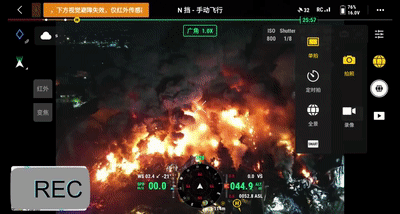
Aerial photography of unmanned aerial vehicles on site
Application of thermal imaging in the investigation of chemical fires
From past cases of fire rescue, it can be seen that chemical plants have a higher probability and risk of fire compared to other places. Especially in industrial areas with dense factory buildings, due to industrial agglomeration and numerous combustibles, the losses caused by safety accidents are extremely serious.
In the application scenario of chemical fires, thermal imaging can intuitively obtain the temperature distribution and fire point location of the fire scene, and can observe the structure of the fire building through the smoke layer, feedback the fire extinguishing and cooling effect, identify potential hazards, and provide important information support for command and rescue.
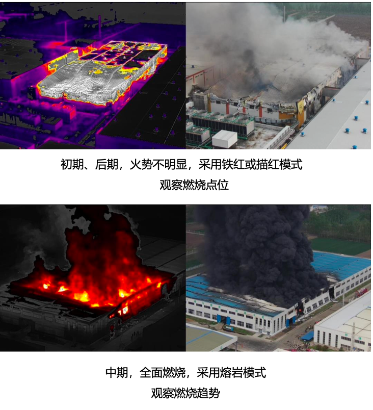
Recommendations for Thermal Imaging Applications
At present, fire reconnaissance drones have been officially included in China's emergency material reserve, which means that drones will play a more important role in normalized disaster prevention and reduction. As a powerful supplement to aerial perspective, drones are becoming a new force in firefighting and rescue. DJI's industry applications will continue to introduce better products and solutions, iterate technological capabilities, deepen the application of tactics, and continuously contribute value to the fire rescue industry.