


Golden Waterway Cruise Tool | DJI Airport Helps Ensure Yangtze River Shipping Safety
The Yangtze River is the busiest river for shipping in the world and is truly a "golden waterway". The Guiding Opinions of the State Council on Leveraging the Golden Waterway to Promote the Development of the Yangtze River Economic Belt clearly states that the construction of the Yangtze River trunk line is necessaryFull coverage, all-weather operation, and fast response capabilityThe water safety supervision and emergency rescue system.
Nanjing Maritime Safety Administration is the largest branch of Jiangsu Maritime Safety Administration, with a total length of 98 kilometers on the Yangtze River Nanjing Main Line under its jurisdiction. The annual number of ships entering and leaving the port reaches 246500,The navigation environment in the jurisdiction is complex, and safety supervision is difficult.
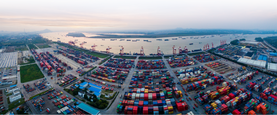
There are numerous ships in the Yangtze River Basin, and the navigation environment is complex
Cruise is an important way for maritime departments to ensure water safety. The traditional boat cruising method requires at least two law enforcement officers and two crew members to form a team, driving the patrol boat to cruise along a fixed route, which consumes a lot of human resources, has a slow response speed, and is costly to use. Conventional unmanned aerial vehicle (UAV) cruising is an emerging mode of cruising in recent years, but it requires high levels of UAV technology and a high operational threshold.
Therefore, reducing reliance on personnel,Introduce unmanned, intelligent, and systematic cruise technologyEffective monitoring and control of jurisdictional waters are particularly important.

Comparison of traditional regulation, pilot mode, and airport mode cruise control
To ensure the safety of Yangtze River navigation and effectively supplement existing cruise methods, Nanjing Maritime Safety Administration has chosen DJI Airport to explore the deployment and application of unmanned airports along the Yangtze River grid.
Strict requirements for water environment
DJI Airport has strong adaptability and can be quickly installed and deployed
Due to the curved section of the Yangtze River and numerous docks, the deployment and installation of DJI Airport need to be as close to the river as possible to reduce communication obstruction. According to the on-site survey, the staff deployed the airport successively on the top of the floating pontoons and the connection part of the wharf in the bridge area.
The riverside environment is humid, with frequent strong winds and large temperature differences. The floating barge on the water has certain shaking, and the top steel structure has limited load-bearing capacity. The entire aircraft at DJI Airport weighs only 105 kg and occupies less than 1 square meter. With a high level of protection, it meets the strict requirements for installation and deployment in water environments. In addition, the integrated design of DJI Airport highly integrates multiple modules, further simplifying the deployment difficulty. At the installation site, the staff only need to fix the airport to the ground, connect it to the power and network, and quickly configure it through the remote control to complete the deployment.
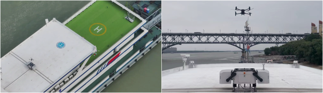
DJI Airport located at the top of the Nanjing Yangtze River Bridge maritime pontoon
Daily Cruise:
DJI Airport+Patrol Boat, "Land Sea Air Space" Three Dimensional Cruise
Nanjing maritime personnel use DJI Sikong 2 to plan routes in advance, set actions for each waypoint, and conduct daily fixed-point patrols at DJI Airport. They conduct regular inspections of key areas such as water construction work areas, ferry areas, bridge areas, tributary river mouths, water source protection areas, as well as fixed-point targets such as navigation marks, docks, anchor ships, and work vessels, and automatically save patrol records.
During the cruise, remote command center personnel and frontline law enforcement personnel can view real-time updates through the DJI Sikong 2 cloud platform to quickly grasp on-site dynamics. Drones, in conjunction with maritime information technology such as VTS, AIS, CCTV, and patrol boats, are stationed in the bridge area water area to maintain passenger ferries crossing the river during peak hours, inspect key water areas such as water source protection zones and water intakes, and promptly detect navigation mark failures, personnel falling into the water, ship loss of control, abnormal ship navigation order, "three no" ships operating illegally, unknown floating objects obstructing navigation, water source pollution, and other emergencies. For different situations, maritime personnel can choose to take photos for evidence collection and immediately dispatch patrol boats for further processing.
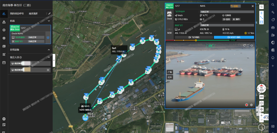
DJI Sikong 2 planned route cruise
DJI Airport supports privatization deployment. The user develops a customized platform based on the airport's "cloud API" to meet the needs of maritime business. It integrates data such as Yangtze River electronic navigation map, high-definition satellite images, DEM elevation, meteorology, and 3D oblique photography, and performs grid labeling on the task area to facilitate water patrol operations and task statistical analysis. The system performs localized data storage and AI edge computing to improve the level of intelligent application.
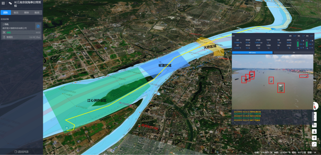
Customized Management Platform for Maritime Drones
Specific mission cruise:
Automated operations at DJI Airport help with traffic diversion
In addition to daily cruising work, DJI Airport also undertakes some cruising work under specific working conditions.
Whether it's temporary flight restrictions or emergency search and rescue missions, DJI Airport can quickly respond to the mission needs of the command center and go to the scene for investigation and disposal as soon as possible. Even in restricted working conditions such as nighttime and heavy fog, the infrared thermal imaging camera equipped on the DJI Jingwei M30T airport version can clearly view the navigation and anchoring operation of ships in the water area, ensuring that the command center can obtain real-time on-site dynamics.
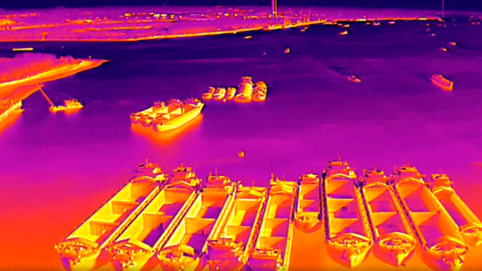
Infrared thermal imaging lens, which can also clearly capture the on-site situation at night
In September of this year, after the passage of the super typhoon "Xuanlannuo", the Nanjing Maritime Safety Administration lifted traffic control on downstream ships. Due to the long duration of this control, the backlog of ships in the Nanjing section of the Yangtze River and the concentrated transit of ships anchored and descending in the Wuhu section of Anhui Province have resulted in a heavy workload for water transportation organization.
For the first time, Nanjing Maritime Safety Administration has utilized DJI Airport to participate in water transportation organization work. Utilize the DJI Sikong 2 cloud platform to plan cruise routes in advance, set scheduled tasks, and immediately initiate cruise missions at DJI Airport after traffic is lifted. The airport cruises once an hour, and the command center and on-site frontline staff remotely monitor the real-time flow of unsealed ships through the Sikong 2,Accurately control the navigation status of the bridge area, timely discover and eliminate hidden dangers and risk pointsOver 2000 ships safely passed through the Yangtze River Bridge in one day.
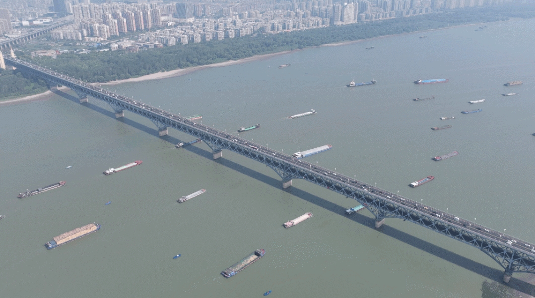
The dense flow of ships after the lifting of traffic control
DJI Airport, with its high frequency of operations, flexible deployment, high stability, and all-weather fully automated unmanned operation, effectively supplements the traditional water cruise mode dominated by patrol ships in maritime departments and replaces some conventional pilot cruise operations.
DJI Airport has been installed and tested in the Nanjing section of the Yangtze River since August this year,Accumulated 1116 safe takeoffs and landings, with over 100 incidents of irregular vessel navigation discovered during drone patrolsAnd timely reminders were given to non-standard ships, effectively ensuring shipping safety. Especially in the recent severe epidemic situation and severe shortage of on-site personnel, the role of DJI hangar in maritime supervision and service has become increasingly prominent.
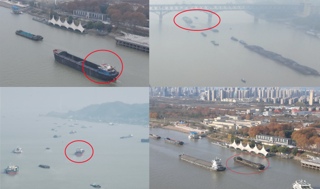
Partial aviation irregularities discovered during airport inspections
With the construction of an integrated water transportation safety guarantee system for land, sea, air and space, DJI Airport will also play a more important role in the maritime field, empowering scenarios such as smart shipping and smart ports, and providing a safe, reliable, convenient and efficient comprehensive solution for the transportation industry.