


Direct Response to Emergency Mission · 2023 | Application of Drones in High Mountain Canyon Earthquakes
On May 16th, the "Emergency Mission · 2023" integrated air ground joint rescue exercise for earthquake disasters in high mountain and canyon areas, jointly organized by the Office of the State Council Earthquake Relief Command, the Ministry of Emergency Management, and the Yunnan Provincial People's Government, was held in Lijiang, Yunnan and other places.
The exercise simulates the scene of a 7.6-magnitude earthquake that occurred in Baisha Town, Yulong County, Lijiang City, Yunnan Province. Buildings collapsed and were damaged, people were buried and trapped, roads, electricity, water supply, and communication in the earthquake stricken area were interrupted, multiple secondary disasters such as landslides occurred, and a large number of tourists were trapped in scenic spots.
After the earthquake, emergency rescue forces from all sides quickly rushed to the earthquake stricken area. To quickly and comprehensively grasp disaster information, a large number of drones were used on site for emergency reconnaissance. Let's take a look at the applications of drones in this exercise!
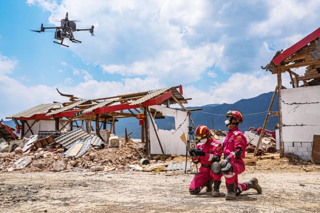
Drone swarm quickly arrived for reconnaissance
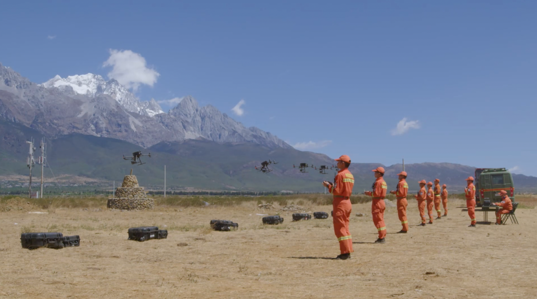
Accurate and efficient rescue, prioritize identifying the disaster situation. The fire brigade used drones to conduct comprehensive and three-dimensional investigations of the on-site situation in the disaster area as soon as possible after the disaster. Drones flying at low altitude in key disaster stricken areasClose up investigation.The application of the M300 RTK drone multi machine cluster can efficiently collect andReconstruct a 3D model of the disaster area,Provide visual data support for the rescue command center to assess the disaster situation, calculate the affected area, and deploy rescue forces.
Small unmanned aerial vehicle indoor reconnaissance
The exercise simulated that after the earthquake, some people in Yunshang Ancient Town were trapped in buildings. Damaged houses pose great safety hazards, and small drones are the first to replace personnel and enter the indoor environment for over the line of sight complex reconnaissance. Firefighters operate the Yu series industry small unmanned aerial vehicles equipped with searchlights, combined with infrared thermal imaging function,Quickly locate trapped individuals inside buildings in dim environmentsIdentify search and rescue routes and assist in developing rescue plans.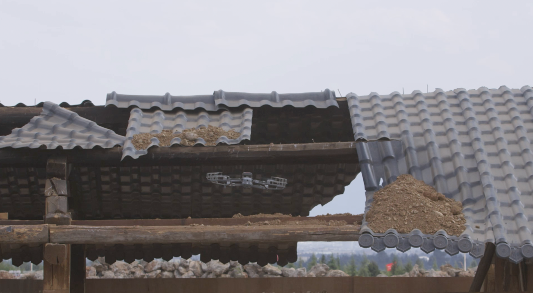
Drone High Mountain Jungle Search and Rescue
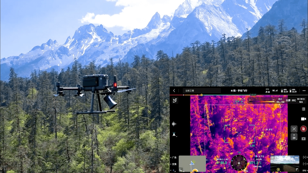
The exercise simulates disaster victims being trapped in mountains and forests, and rescue personnel need to cross mountains and valleys to search, which is difficult. The use of drones to assist ground search and rescue teams in conducting aerial searches can significantly improve search and rescue efficiency. Rescue personnel uselongitude and latitudeM300 RTK equipped with a loudspeakerLaunch a call to search for key areas. Simultaneously activate the droneinfrared thermographyConduct a carpet search for signs of life. Apply after discovering trapped individualsDot positioningFunction to obtain precise location information and guide ground search and rescue teams to successfully carry out rescue operations.
Drones empower power emergency support
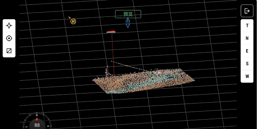
After the earthquake, the power supply of the 500kV Ajinyi line, which is the main artery of the West East power transmission, was interrupted, and the situation is urgent. Yunnan Power Grid Company uses small drones to conduct rapid surveys on the collapse of the A-Jin Yi line iron tower and the damage to the line itself. At the same time, it uses latitude and longitude M300 RTK equipped with Zenith L1 laser radar to conduct surveys in areas with severe equipment damagethree-dimensionalLaser point cloud modelingAssist repair personnel in accurately assessing the damage to facilities and developing plans.When laying power lines, drones are used to release traction lines to help repair personnel quickly replace damaged wires and rebuild power channels.
Drone assisted rescue of high-altitude cable car
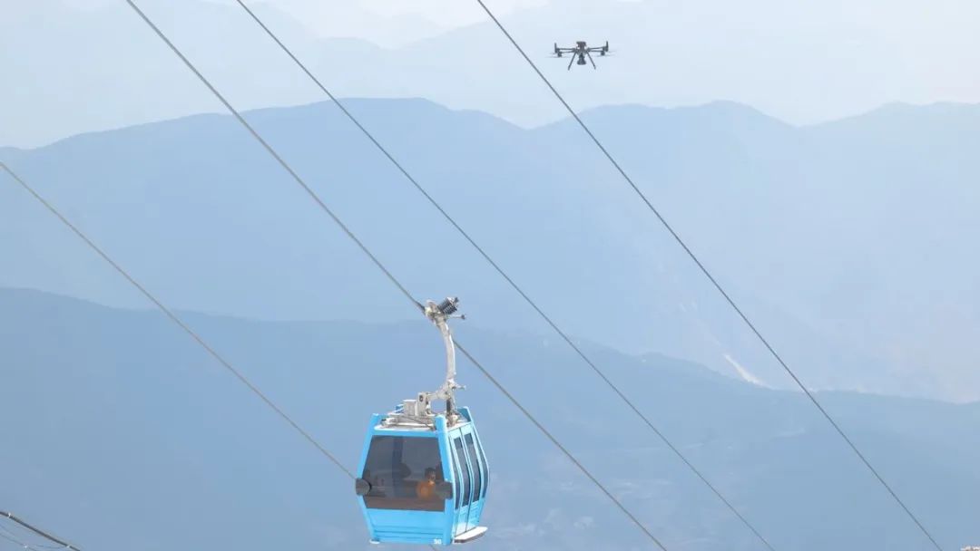
The exercise simulates tourists being trapped in high-altitude cable cars after the earthquake, with high altitude and large altitude differences. The rescue plan needs to be carefully formulated. Using longitude and latitude M300 RTK to observe the trapped state of the cable car and the surrounding environmental situation information from the air, providing guidance for ground rescue forces.
Drones participate in avalanche rescue operations
The exercise simulates a scene where an avalanche is triggered after an earthquake and people are injured and trapped. Drones take off at high altitudes to assist ground search and rescue personnel in quickly conducting large-scale searchesinfrared thermographyFunction: Accurately locate trapped individuals on snow capped mountains, improving search and rescue efficiency.
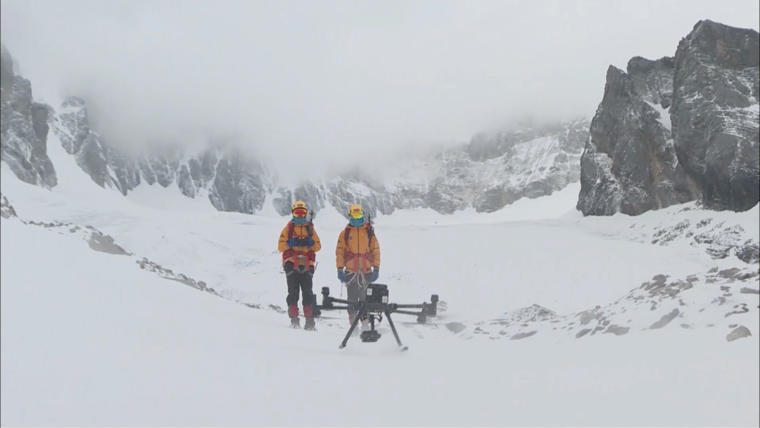
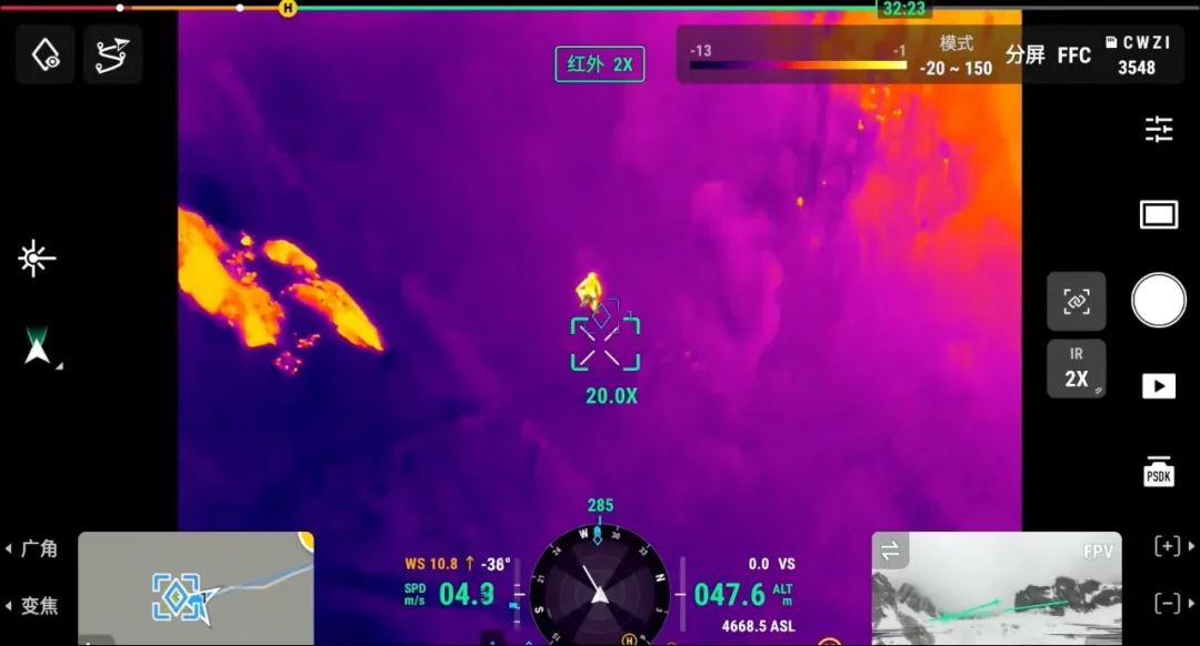
Quick detection of trapped personnel using the longitude and latitude M300 RTK thermal imaging mode
Avalanche prone personnel falling off cliffs, simulation exercises simulate this scenario, with drone assistance in harsh terrain environments with large altitude differencesPull the rescue towing ropeAssist ground rescue teams in quickly establishing rescue channels.
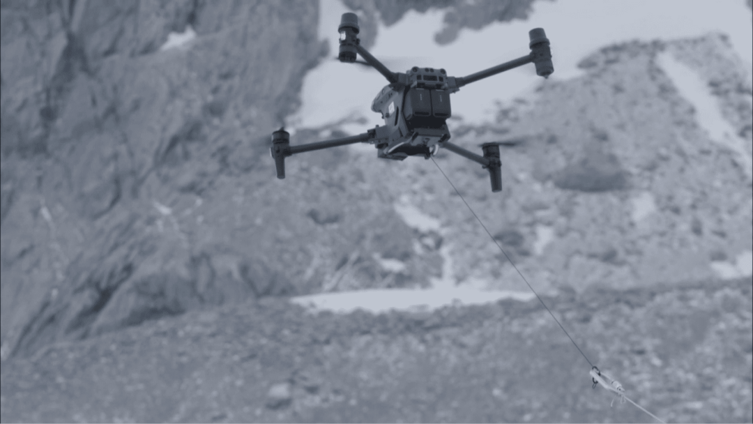
Jingwei M30T traction rescue rope
This exercise is aimed at addressing a series of rescue challenges related to earthquake disasters in high mountain and canyon areas. It adopts a joint approach between air and ground in multiple scenarios, fully utilizing the strong maneuverability and resilience of unmanned aerial vehiclesThe characteristic of small terrain restrictions effectively improves disaster relief efficiency and safeguards the safety of operators.
In the future, DJI's industry application will continue to adhere to empowering emergency rescue with advanced technologies such as drones, and promote continuous innovation of emergency tactics and tactics for all types of disasters.