


How to empower railway construction throughout the entire lifecycle of unmanned aerial vehicle surveying engineering applications?
In recent years,UAV aerial surveyThe rapid development of technology has become an important means of information collection. In the field of engineering construction, from survey and design, construction to delivery and operation,droneProvide important data support.
The Surveying and Mapping Institute of China Railway Design Group Co., Ltd. adopts emerging products such as DJI industry drones. And through independent research and development of management platforms, conduct comprehensive inspections of the entire railway engineering line. Empower railway engineering construction throughout its entire lifecycle, from pre construction, during construction, to post construction.
Land acquisition and demolition before construction:Measure area and confirm land attributes
Before the official construction of the railway, land acquisition and demolition must be carried out first. Using traditional methods to investigate the current situation of regional land acquisition and demolition is not only costly and slow, but also prone to disputes during the mapping process, which affects the progress of the project. And the efficiency of drone collection is manual More than 10 times, it can efficiently obtain real-life 3D models, which serve as the basis for demolition, are more objective, and have high credibility.
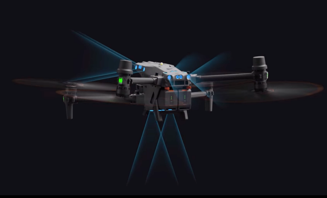
After the railway survey, utilizelongitude and latitude M300 RTKEquipped with a full frame cameraZen contemplation P1Or tilt the camera to obtain real-time 3D data of the land use area, covering a range of 100m on both sides of the centerline, with a resolution (GSD) of not less than 5cm. Finally, the railway department confirms the relevant attributes of the relocated land through a combination of digital models and on-site investigations.

Realistic 3D demolition management
Horizontal and vertical section measurement: quickly obtain terrain elevation point data of the section
Horizontal and vertical section measurement is a common measurement in engineering survey and design, which can be used to design the shape of the cross-section of the line, calculate the slope, calculate the amount of earthwork, layout the slope, and arrange various structures.
Manual adoption is required RTK, on the other hand, is time-consuming, labor-intensive, and difficult to achieve the required accuracy for traditional cross-sectional surveys, total stations, and other instruments that measure every point. In addition, railways often pass through mountain basins and river valleys, making it extremely difficult to use traditional measuring instruments, and the risk of manual on-site operations is high.
By latitude and longitudeM300 RTK、Mavic 3ERepresented by surveying drones, they can efficiently and without image control obtain high-precision terrain data. Based on unmanned aerial vehicle aerial survey results such as digital orthophoto, digital surface model, real 3D model, and laser point cloud data, quickly extract cross-sectional terrain elevation point data required for engineering construction.

Cross section cutting
Measurement of earthwork volume during construction: comparative analysis of changes in multi-stage 3D models
The measurement of earthwork volume is an important step in engineering construction, and due to its direct impact on the cost of the project, it requires extremely high accuracy in elevation surveying. However, traditional earthwork measurement has low density of measurement points and unclear representation of characteristic terrain, resulting in low field efficiency and large workload.
Adopting the latitude and longitude of DJI Equipped with M300 RTKZen Thinking L1Collecting LiDAR point cloud data can obtain high-density measurement points, quickly obtain on-site data, and greatly improve the efficiency and accuracy of earthwork measurement. Based on the comparison of multiple 3D models, it can also automatically analyze the changes in excavation and filling volume, and calculate the volume of excavation and backfill materials.

Analysis of changes in excavation and filling volume
Construction supervision: unmanned aerial vehicle high-altitude monitoring without blind spots
Railway engineering has the characteristics of wide scope and long construction period, and monitoring the construction progress and managing the impact on the environment along the line are key tasks.
DJI droneFlexible and adaptable, equipped with zoom cameras and thermal imaging cameras, dynamically monitoring the construction site conditions and comprehensively managing the construction progress. In addition, by utilizing video space fusion technology, videos captured by drones can be overlaid with digital background maps to achieve precise correspondence between video information and real locations.

Overlay of videos captured by drones with digital background images
Meanwhile, utilizing AI technology automates the extraction of key information from videos, enabling rapid identification of key information in the overall construction progress and improving overall inspection efficiency.

Comparison of intelligent synchronization of multiple videos
In response to the issue of sewage discharge during construction, drones are used to monitor large temporary facilities such as mixing stations, slab yards, and beam yards around the clock, quickly and accurately inspecting behaviors such as illegal sewage discharge, illegal sand discharge, and leakage discharge. Any problems discovered are targeted and located, making it easier for staff to handle them in a timely manner.
[After construction] Project reality 3D: back to multiple angles”Fine modeling of flight routes
After the completion of railway engineering, in order to digitize the overall appearance of the project site and effectively assist in the operation and maintenance of the project, a refined 3D model for the main railway project is essential.
However, according to the Regulations on Railway Safety Management, the surrounding areas of the railway Drones are prohibited from flying within a range of 500 meters. Ordinary five directional oblique photography or orthophoto routes require drones to cross directly above railways, which is not suitable for 3D reconstruction of railway operations.
The Surveying and Mapping Institute of China Railway Design Group Co., Ltd. independently developed a railway based on the open route format of DJI dronesDrone Rotation Multi Angle Route MissionSetting up railway safety zones as restricted areas and planning multi angle flight routes on both sides of the railway effectively solves the problem of fine modeling of railway main engineering.

Schematic diagram of railway route for "UAV rotation multi angle route task"

refined modeling
Maintenance inspection: precise shooting of automated inspection facilities
In the daily operation of railways, it is necessary to regularly maintain and repair bridges and other equipment to prevent and repair catastrophic damage. However, due to the complex structure of railway engineering, the inspection workload is heavy.
Based on the real-life 3D model of railway engineering, DJI drones solidify the operation range, route, flight altitude, overlap, flight speed, camera attitude angle, etc., determine the key inspection area targets, and annotate key information. After fixing the route, use visible light zoom lens to accurately capture the fine structure of the project, analyze and compare the data, and quickly identify problems.

Collapse of cable tray cover plate

Cement board cracking
It is worth mentioning that the footage captured by the drone can be synchronized in real-time to the cloud, and the staff can view the information in real-time on multiple terminals such as computers and mobile phones. The photos and videos captured will be automatically archived and displayed as visual inspection or patrol results.

Real time viewing of data results
Dangerous rock survey: high-precision model monitoring and evaluation of hazard factors
In mountainous railways, dangerous rocks and rockfalls are a major factor threatening train safety, therefore, measuring and warning of dangerous rocks is crucial.
Self developed by the Surveying and Mapping Institute of China Railway Design Group Co., LtdThe "Dangerous Rock Falling Analysis System" uses high-precision 3D real data from tunnel entrances and high slope areas of roadbeds to monitor dangerous rock falling. Through quantitative analysis, information such as the center of mass, volume, and dip angle of dangerous rocks can be calculated. Based on the parameters of dangerous rocks and accurate digital terrain models, a rolling trajectory estimation model is constructed to simulate and estimate the rolling trajectory and impact capacity, effectively evaluating the danger factor of dangerous rocks.

Identification of dangerous rocks
In the application of dangerous rock and rockfall remediation in a railway project in the east, staff discovered a total of dangerous rocks and rockfalls through drones39 locations have greatly improved the efficiency of rectification and reduced the difficulty and danger factor of patrolling personnel in mountainous areas.
The application of drone aerial surveying technology in railway construction comprehensively enhances the digitalization level of engineering construction and provides important information support for design, construction, and operation. For repetitive measurement and inspection operations in railway engineering, Asia needs a fully automated solution.
Last year,DJI Airportemerge as the times require,The 7 * 24-hour unmanned solution brings a new operating mode to the industry. Without the need for personnel to arrive at the site, DJI Airport can complete operations fully automatically and can be widely used in engineering construction management, daily safety inspections, flood prevention special inspections, monitoring of dangerous rocks and rockfalls, traffic protection zone inspections, and other aspects. In the future, DJI industry will continue to create more intelligent solutions and use technology to promote the transformation and upgrading of engineering construction surveying.